
The Schuylkill River has profoundly shaped the rise and development of Philadelphia, and indeed, much of Pennsylvania through which it flows. This 135-mile river, a tributary of the Delaware River, still provides drinking water for three million people today. Let’s dive into the history of this vital aquatic artery. Read more at philadelphia.name.
Early Settlers and the Birth of a City
Long before Europeans arrived, indigenous tribes thrived along the banks of the Schuylkill. The Lenape people lived in groups along the river, referring to it as “Ganshowahanna,” meaning “falling water,” and “Manayunk,” which translates to “place where we drink.”
The river’s modern name was coined by sailor Arendt Corssen in 1628. He was the first European to navigate its waters and chose to call it the “hidden river” due to its inconspicuous mouth. In 1633, Corssen was appointed commissioner and acquired the first lands from the Lenape at the confluence of the Schuylkill and Delaware rivers. A fort was built there, remaining in use until 1651.
Later, William Penn decided to establish a city here, which we now know as Philadelphia. He also purchased land from the Lenape to avoid conflicts. The riverside location was advantageous for urban development, allowing for the transport of building materials and food by water. These goods were primarily moved in the spring when water levels were high.
Industrial Development
The Schuylkill River boasts numerous tributaries, which facilitated the construction of dams, mills, and industrial enterprises. However, for a long time, making the waterway navigable proved challenging due to natural rapids. This problem was finally solved in 1824 through these efforts:
- In 1815, with the support of the state government, a local navigation company was established.
- This company began constructing canals, pools, and dams.
- The process was arduous but ultimately successful.
Interestingly, the initial goal of making the Schuylkill navigable was for transporting grain and other foodstuffs, but coal soon became the dominant cargo. By the 1860s, countless ironworks, factories, and foundries had sprung up in the river valley. Villages transformed into bustling towns, populations swelled, and railway stations opened.
However, a new challenge emerged: providing clean water to Philadelphia. In 1799, the city established a water committee. The Schuylkill was designated as the primary source of drinking water for city residents, and construction began on a new water supply system. Hills on the river’s east bank were chosen for this purpose, and plans for a dam were drawn up. The city government acquired local properties, creating not only a waterworks but also the picturesque Fairmount Park.
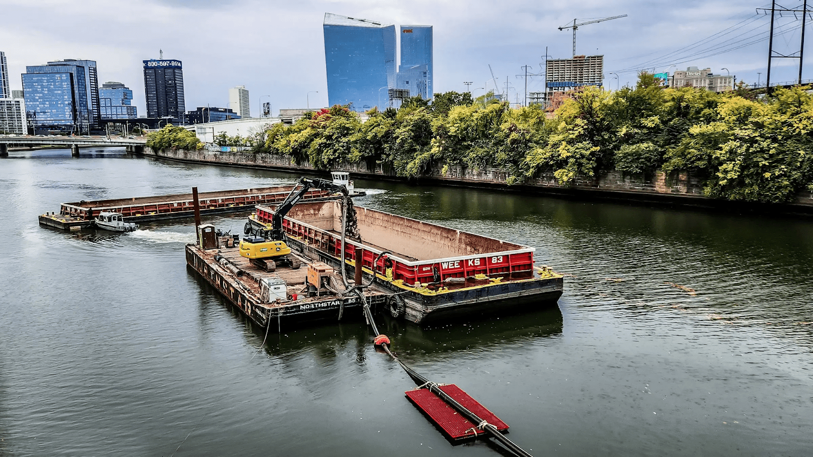
As industrial facilities along the river’s banks rapidly increased, water quality just as quickly deteriorated. In 1927, the U.S. Army Corps of Engineers estimated that the Schuylkill and its tributaries contained 38 million tons of coal industry waste. The water was also polluted by sewage due to inadequate wastewater systems.
Balancing Industry and Nature
In the early 20th century, city residents began noticing the poor water quality and appealed to the authorities for a solution. In 1937, Pennsylvania passed the “Clean Streams Law,” and in the 1940s, a massive restoration effort for the waterway began. Extensive cleanup operations lasted for a decade and marked the first state-level initiative of its kind. However, the most active period of Schuylkill River cleanup occurred in the late 20th century.
Furthermore, the Pennsylvania Department of Conservation and Natural Resources recognized the Schuylkill River and its basin as a state heritage area in 1995. Congress designated the river as a national heritage area in 2000. This officially cemented the Schuylkill River’s important status for the country, allowing for extensive restoration and protection efforts moving forward.
In 2000, the formation of the Schuylkill River Valley National Heritage Area began, driven by the need to overcome environmental challenges. Many associations and projects were established to clean the river and restore its scenic banks. The active involvement of both citizens and authorities in this process was crucial, as everyone shared an interest in revitalizing the waterway.
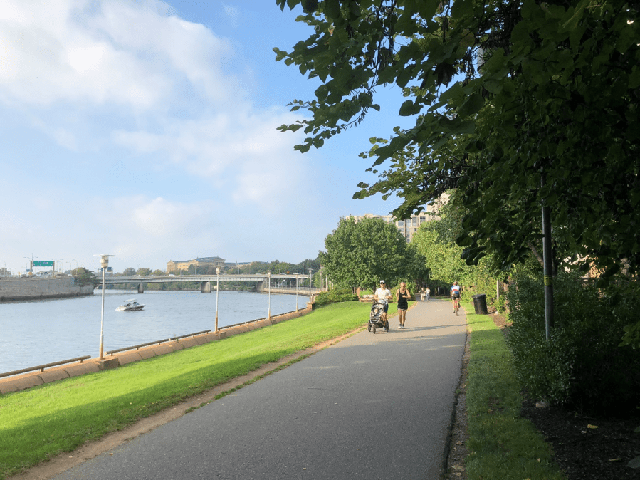
One notable outcome of these efforts is the recreational area along the river, stretching from downtown Philadelphia. This 30-mile waterfront is a beloved spot for family strolls, cyclists, and runners.
To find a balance between industry and nature, efforts also began to reclaim gardens in Southwest Philadelphia. North America’s oldest botanical garden, Bartram’s Garden, educates residents and visitors about the river’s natural features and the importance of preserving them.
Thanks to the work of conservationists, forests once again cover approximately 41% of the Schuylkill River basin. Agriculture and industrial facilities still operate along its banks, but they now implement eco-friendly technologies and prioritize the river’s health. That’s why the Schuylkill continues to supply drinking water to three million local residents, remaining a beautiful natural gem and a navigable river that plays a significant role in Pennsylvania’s industrial life.